Before planning an addition, garage, ADU, pool, deck, shed, or another improvement, you need to understand where your property actually begins and ends. Knowing how to find property lines can help prevent design mistakes, setback issues, and conflicts that may affect your permit application.
At SitePlan California, we have seen firsthand that homeowners often assume fences, walls, hedges, or driveways mark the legal boundary. Sometimes they do. Sometimes they do not. That difference can completely change where a project can be built.
Why Property Lines Matter Before You Design
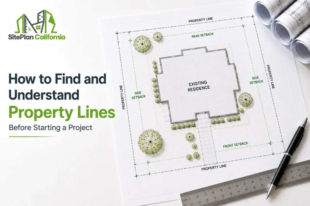
Property lines define the legal boundary of a parcel. They are important because many zoning and permit requirements are measured from those boundaries. Setbacks are one of the clearest examples.
If a city requires a structure to remain a certain distance from a side or rear property line, the project team needs reliable boundary information before determining whether the proposed location works.
Property lines can affect:
- Building setbacks
- ADU placement
- Garage and shed locations
- Pool positioning
- Deck and patio design
- Easements and access
A proposed structure may look comfortably inside the yard but still be too close to the actual parcel boundary. That is why visual estimates should not replace reliable property information.
Where Can You Find Property Line Information?
There are several places to begin researching a property’s boundaries. Some sources provide better information than others.
An existing land survey is often one of the most useful documents because it may show parcel dimensions, boundary lines, monuments, easements, and other property information prepared by a licensed professional. Recorded parcel or subdivision maps may also provide useful dimensions and lot configuration.
Previous site plans can help, especially when they were prepared from reliable source information. Assessor records can provide parcel context, but they should not automatically be treated as a professional boundary survey.
When researching a property, useful sources may include:
- Existing boundary surveys
- Recorded parcel or subdivision maps
- Previous permit site plans
- County assessor parcel information
- Title or property documents
- Recorded deeds and legal descriptions
The strongest approach is to compare available information rather than rely on one convenient source without understanding what it represents.
Is a Fence the Property Line?
Not necessarily. This is one of the most common mistakes we see.
A fence may have been installed directly on the boundary. It may also have been placed several inches or several feet inside one owner’s property. An older fence may even follow a convenient landscape line rather than the legal parcel boundary.
The same warning applies to:
Walls.
Hedges.
Driveway edges.
Rows of trees.
Landscaping.
These features can provide context, but they do not automatically establish legal ownership boundaries. I always advise clients not to design a project around a fence line unless reliable information supports that assumption.
This becomes especially important when the proposed construction is close to a required setback.
Can Online Parcel Maps Show Your Exact Boundary?
Online parcel maps are useful research tools. They can help identify the general shape of a parcel, Assessor Parcel Number, surrounding lots, and other property information.
However, the lines displayed on an online map should not automatically be treated as survey grade boundaries. Aerial imagery can also introduce visual alignment differences.
For example, an online boundary line may appear to pass through a fence or building because the map layer and aerial image are not perfectly aligned. That does not necessarily mean the building crosses the legal boundary.
This is why we use public mapping as research information rather than representing it as a professional boundary determination. If exact location matters, stronger property records or a licensed survey may be required.
How to Read Property Dimensions on Existing Plans
An existing survey or site plan can contain several important numbers. You may see dimensions along each side of the parcel. For a simple rectangular lot, these may show the width and depth of the property.
Irregular parcels can be more complicated. They may contain multiple boundary segments with different lengths and directions. You may also see measurements between the property line and existing structures.
These are particularly useful when evaluating setbacks. Before relying on an older drawing, check whether it clearly identifies:
- Parcel boundaries
- Lot dimensions
- Existing structures
- Distance from structures to boundaries
- Easements
- Drawing scale
The date of the document also matters. A valid boundary survey may still provide useful boundary information years later, but improvements shown on that survey may no longer reflect current site conditions.
The boundary information and the building information should therefore be evaluated separately.
When Should You Consider a Professional Survey?
Not every site plan project automatically requires a new survey. There are situations, however, where professional boundary confirmation becomes much more important.
Consider an addition that is proposed only slightly farther from a property line than the minimum setback. If the boundary location is uncertain, estimating from a fence can create significant risk.
A survey may also become important when:
There is a boundary dispute.
Property markers cannot be identified reliably.
Existing records conflict.
The proposed construction is very close to a setback limit.
The reviewing authority requires professionally verified boundary information.
A drafting company and a licensed land surveyor perform different services. At SitePlan California, we can prepare site drawings from reliable source information, but we do not claim to professionally establish legal boundaries when surveying services are required.
That distinction is fundamental to trustworthy permit drafting.
How Property Lines Affect Setbacks
The relationship between boundaries and setbacks is simple but extremely important. Imagine a local rule requiring a structure to remain five feet from the side property line.
The five feet is normally measured from the relevant legal lot line, not from a fence that happens to be nearby. If the fence sits one foot inside the property, measuring five feet from the fence could place the structure six feet from the true boundary.
But if the fence sits one foot onto the neighboring property, the same assumption could place the new construction too close to the actual line. This is why understanding how to find property lines matters before setback measurements are treated as final.
A setback calculation is only as reliable as the boundary information used to create it.
Real World Scenario: The Fence Was Not the Boundary
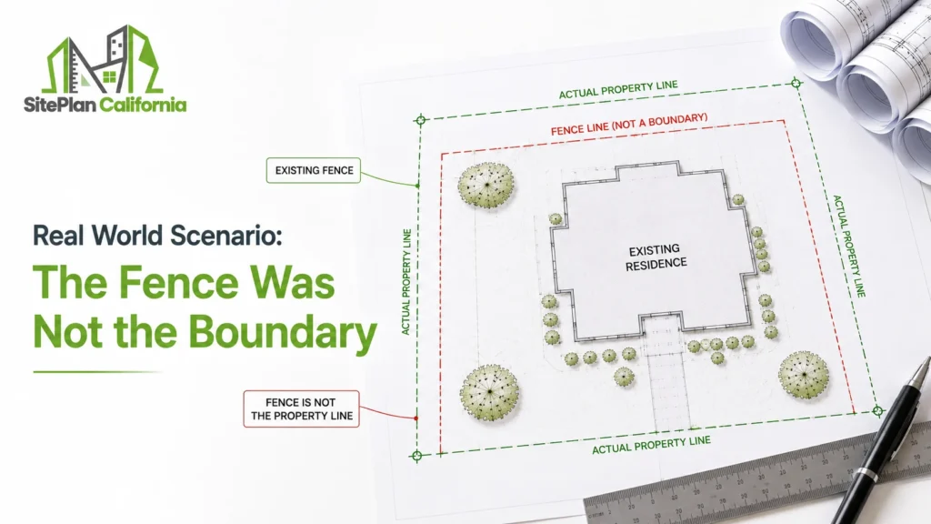
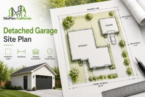
Consider a homeowner planning a detached garage. There is a fence along the side of the property, and the homeowner wants to place the garage several feet away from it. Visually, the location appears compliant.
Before drafting the permit site plan, an older survey is reviewed. The survey shows that the legal property boundary does not follow the fence exactly. Part of the fence was installed inside the homeowner’s parcel. This changes the available dimensions.
In this particular situation, the homeowner actually has more usable space than expected. The opposite could also happen. If the fence were located outside the legal boundary, relying on it could make the proposed garage appear farther from the property line than it really is.
The important point is not whether the fence helped or hurt the project. The important point is that the design decision changed once reliable boundary information became available. That is why property research should come before final placement.
What If Property Documents Show Different Measurements?
Conflicting information deserves attention.You may find one lot dimension on an older site plan and another number on a different document.
Do not simply choose the measurement that creates more space for the project.First determine what each document represents.
An assessor map, recorded subdivision map, old permit drawing, and professional survey are not necessarily equivalent sources.
The difference may result from:
- Rounding
- Drawing scale
- Old or inaccurate information
- Different measurement methods
- Parcel changes
- Simple drafting errors
If the conflict affects a critical setback or construction location, professional clarification may be necessary.
I prioritize resolving important inconsistencies early rather than carrying uncertain numbers through the entire design process.
How Property Lines Affect Easements
Property boundaries and easements are related but separate.The property line defines the parcel.
An easement can exist within that parcel and give another party specific rights over part of the property.For example, a utility easement might run five or ten feet inside a rear property boundary.
A proposed garage could therefore satisfy the required zoning setback while still overlapping the easement.This is why a site plan should consider more than the outer boundary.
When reliable information is available, it can also show relevant easements and their relationship to the proposed project.
Understanding both conditions creates a much more complete picture of the buildable area.
Why Property Lines Should Be Reviewed Early
Property boundaries influence too many other decisions to leave them until the end.
If you wait until detailed plans are complete, a boundary problem can force changes to:
Building dimensions.
Structure placement.
Floor plans.
Engineering.
Driveway layout.
Pool location.
ADU positioning.
Early site review gives the project more flexibility.
At SitePlan California, we have seen firsthand that moving a proposed structure during early planning is far easier than redesigning a completed permit package.
That does not mean every property needs expensive boundary work before any idea can be discussed.
It means the level of boundary certainty should match the risk of the project.The closer construction comes to a legal limit, the more important reliable information becomes.
Why Choose Us for California Site Plan Drafting?
We focus on using property information responsibly and clearly showing what is known about the site.
- We review available surveys, plans, parcel records, and project information
- We clearly show relevant property boundaries based on the available source material
- We avoid treating fences and aerial imagery as automatic proof of legal boundaries
- We can incorporate existing and proposed structures into a clear site drawing
- We explain when a licensed land surveyor or another professional may be required
Frequently Asked Questions
What is the easiest way to find my property lines?
Start with an existing survey, recorded parcel information, previous site plans, and other property records. If exact legal boundary confirmation is required, a licensed land surveyor is the appropriate professional.
Are online property maps accurate enough for permits?
They can be useful for research but should not automatically be treated as survey grade boundary information. Their suitability depends on the project and local requirements.
Is my backyard fence legally on the property line?
Not necessarily. A fence can be on, inside, or sometimes outside the legal boundary. Reliable records or a survey are needed when exact location matters.
Do I need a survey before preparing a site plan?
Not every project requires a new survey. It depends on the available boundary information, project location, permit requirements, and how important exact boundary confirmation is.
Why are property lines important for building permits?
Setbacks and other development requirements are often measured from property boundaries. Incorrect boundary assumptions can therefore affect whether a proposed structure appears compliant.
Conclusion
Knowing how to find property lines is an important step before designing a project near the edge of a property. Surveys, recorded maps, previous plans, and parcel information can all provide useful evidence, but visible fences and online maps should not automatically be treated as legal boundaries. SitePlan California focuses on using reliable source information so proposed improvements can be positioned with greater clarity.