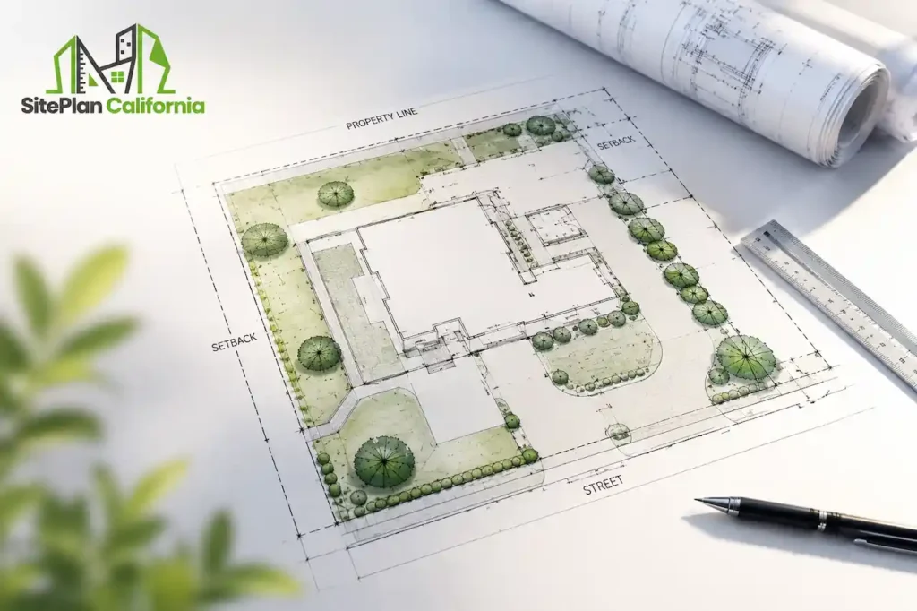
California permit site plan: site plan is one of the key drawings used to explain how a proposed project fits on a property. For a permit application, it needs to do more than show where a new building will go. The plan should give the reviewing department a clear picture of the property, existing conditions, proposed improvements, access, setbacks, and other information relevant to the project.
The exact requirements for a California permit site plan vary by city, county, property, and project type. A residential addition may require less information than a commercial development or a project involving grading and drainage. Local agencies can also have their own checklists, scales, formatting rules, and additional requirements.
Knowing what belongs on the plan before submitting your application can help reduce avoidable corrections and review delays.
What Is a Permit Site Plan?
A permit site plan is a scaled drawing that shows the property from above and identifies existing and proposed site features. The drawing typically connects several pieces of information in one view:
- Property boundaries
- Existing structures
- Proposed construction
- Setbacks
- Dimensions
- Streets and access
- Parking
- Easements
- Utilities
- Site improvements
- North arrow and drawing scale
The purpose is to help the reviewing agency understand exactly what is being proposed and where it will be located.
For example, the City of San Diego describes a typical site plan as a drawing showing property lines, easements, public rights-of-way, and existing and new structures, along with dimensions and other project information.
1. Property Lines and Lot Dimensions
Property boundaries are one of the most important elements of a site plan. The plan should clearly identify the entire property and show the dimensions of the lot lines. Depending on the jurisdiction, the drawing may also need information about streets, alleys, rights-of-way, or the legal relationship between the property and surrounding public areas. Property lines establish the reference point for many other measurements on the plan.
Without accurate boundaries, it becomes difficult for a reviewer to determine whether a proposed structure meets the required setbacks or whether it conflicts with an easement or right-of-way. California jurisdictions commonly require dimensioned property lines. Contra Costa County, for example, requires the outline of the entire property with all property lines and a north arrow on residential site plans.
2. Existing Structures
A permit site plan should generally show the structures that already exist on the property. Depending on the project, these may include:
- Main residence
- Detached garage
- ADU
- Shed
- Pool
- Deck
- Patio
- Retaining walls
- Other accessory structures
Each structure should be located accurately and labeled clearly. This helps the reviewer understand the current condition of the property before evaluating the proposed work.
For example, if you are adding an ADU behind an existing house, the site plan should show the house, the proposed ADU, and the distances between them and the property boundaries.
3. Proposed Improvements
The proposed work should be easy to identify. A good plan should make it clear what already exists and what is being added, removed, relocated, or modified. Depending on the project, proposed improvements could include:
- Home additions
- New homes
- ADUs
- Garages
- Pools
- Patios
- Driveways
- Retaining walls
- Fences
- Other structures or site improvements
The scope of work should also be clearly communicated. San Diego’s site plan guidance specifically calls for a brief statement describing the proposed scope of work. Clear labeling prevents confusion during review and makes the plan easier to understand.
4. Setbacks From Property Lines
Setbacks show the distance between structures and property boundaries. These measurements are especially important because zoning requirements may establish minimum front, side, and rear setbacks. A site plan should clearly show the required and proposed setback distances where applicable.
For example, if a homeowner proposes a rear addition, the plan should show the distance from the addition to the rear property line. If a detached garage is proposed, the relevant side and rear setbacks may also need to be shown.
Contra Costa County requires setbacks from front, rear, and side property lines to be shown for proposed and new construction. Accurate setback information allows the reviewer to determine whether the proposed location complies with applicable requirements.
5. Building and Site Dimensions
Dimensions help the reviewer understand the size and position of the proposed improvements. A site plan may need to show:
- Building length and width
- Addition dimensions
- Distances between structures
- Distance from structures to property lines
- Driveway dimensions
- Parking space dimensions
- Easement widths
- Street or right-of-way dimensions
The dimensions should be clear enough that the reviewer does not have to estimate distances from the drawing. San Diego’s current guidance specifically calls for dimensions of existing and proposed buildings and structures, dimensions to property lines, and dimensions between structures.
6. North Arrow and Drawing Scale
A north arrow establishes the orientation of the property. The scale tells the reviewer how the measurements shown on the drawing relate to actual distances on the site. Both are basic but important elements of a permit drawing.
California jurisdictions may specify acceptable scales for different projects. El Dorado County, for example, lists conventional scales such as 1 inch = 10 feet and 1 inch = 20 feet for certain site and plot plans.
The appropriate scale can depend on the size and complexity of the property. Always follow the requirements of the agency reviewing your application.
7. Streets, Rights-of-Way, and Access
The relationship between the property and surrounding streets should be clear. Depending on the project, the site plan may need to identify:
- Adjacent streets
- Alleys
- Rights-of-way
- Sidewalks
- Curbs
- Driveways
- Curb cuts
- Pedestrian entrances
- Vehicle access
These features help the reviewing department understand how people and vehicles reach the property.
For example, San Diego requires information about public right-of-way dimensions and existing and proposed public improvements such as curbs, sidewalks, pedestrian ramps, and driveways.
8. Parking Areas
Parking may need to be shown for both residential and commercial projects, depending on the scope and local requirements.
The site plan may identify:
- Existing parking spaces
- Proposed parking spaces
- Parking dimensions
- Drive aisles
- Accessible parking where applicable
- Loading areas for certain commercial projects
For commercial projects, parking and circulation can become a significant part of the site review. A clear parking layout allows the reviewing agency to evaluate how the proposed development affects the available site area and vehicle circulation.
9. Easements and Utility Areas
Easements should not be overlooked. An easement can give another party or agency certain rights over part of the property, potentially limiting where construction can occur.
Depending on the property, easements may involve:
- Utilities
- Drainage
- Access
- Roads
- Public rights-of-way
The location and dimensions of recorded or proposed easements may need to be shown. This is particularly important because placing a proposed structure over an easement can create problems during review or construction. San Diego specifically warns that failing to identify recorded easements can result in additional reviews, fees, construction changes, and processing delays.
10. Utilities and Site Services
Utilities may also need to be identified, particularly when the proposed project affects existing connections or requires new services. Depending on the property and project, these may include:
- Water
- Sewer
- Gas
- Electrical
- Storm drainage
- Septic systems
- Utility equipment
Some jurisdictions require the location of visible utilities, while more detailed projects may require additional utility information. San Ramon, for example, asks applicants to show easements and visible utilities on certain residential and commercial plot plans.
11. Driveways and Pedestrian Access
Driveways should be shown clearly when they are relevant to the project. A site plan may need to identify:
- Existing driveways
- Proposed driveways
- Driveway widths
- Curb cuts
- Walkways
- Entrances
- Pedestrian paths
If the project changes access to the property, additional information may be necessary. For example, a new ADU or commercial improvement could affect parking or vehicle circulation, making accurate access information important during review.
12. Landscaping, Fences, and Other Site Features
Some projects require more than buildings and property lines. Depending on the jurisdiction and project, the site plan may also need to show:
- Existing trees
- Proposed landscaping
- Fences
- Walls
- Hardscape
- Lighting
- Signs
- Outdoor equipment
- Pools
- Other site amenities
The level of detail depends on the project. Lemon Grove’s current site plan guidance, for example, includes structures, parking, landscaping, fencing, lighting, utilities, easements, drainage, and grading among the information that may need to be shown for an ADU site plan.
13. Grading and Drainage Information
Not every simple permit project requires a detailed grading plan, but site conditions involving slopes, drainage, or changes to ground elevations can require additional information. Depending on the project, this may include:
- Existing grades
- Proposed grades
- Contours
- Drainage patterns
- Drainage systems
- Retaining walls
- Slopes
- Elevations
California’s Department of Housing and Community Development notes that grading and drainage plans can require property limits, existing contours, terrain information, drainage areas, proposed grading, drainage devices, and affected structures. If grading or drainage is part of the project, the site plan should be coordinated with any required engineering or grading documents.
Why Missing Information Can Delay Permit Review
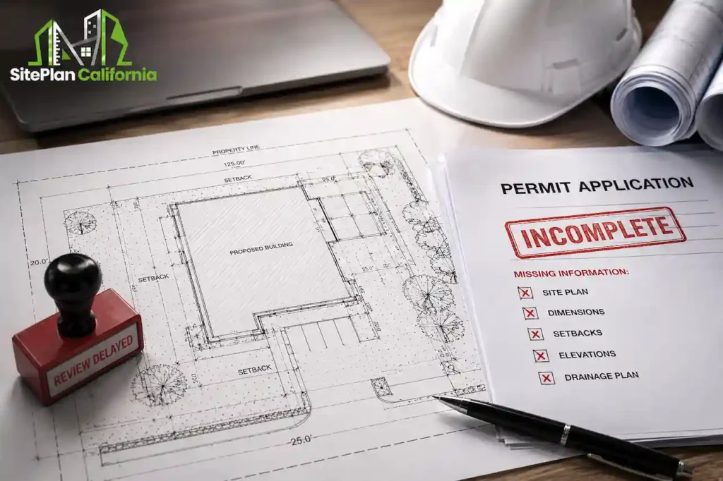
A California permit site plan does not have to contain every possible piece of information. It does need to contain the information required for the specific project and jurisdiction. Missing or unclear information can create questions that have to be resolved before the review can continue. Common problems include:
- Missing property dimensions
- Unclear setbacks
- Missing easements
- Incorrect structure locations
- Unclear existing and proposed conditions
- Missing access information
- Incomplete parking dimensions
- Missing north arrow or scale
- Inadequate site measurements
- Poorly labeled features
These issues can lead to correction comments and resubmittals. The City of San Ramon notes that poorly prepared plans or plans lacking necessary information may not be accepted for submittal. That is why preparing the site plan around the actual project requirements is more useful than simply using a generic template.
Does Every California Permit Site Plan Look the Same?
California permit site plan does not use one universal site plan checklist for every project. Requirements can vary based on:
- City or county
- Project type
- Property size
- Zoning
- Existing conditions
- Commercial or residential use
- Grading requirements
- Access conditions
- Easements
- Environmental or site constraints
For example, a simple residential addition may need a relatively straightforward plot plan, while a commercial development can require parking, loading, utilities, landscaping, circulation, lighting, and surrounding site information. San Luis Obispo County’s coastal ADU requirements illustrate how additional site information can be required when property conditions and location create specific review considerations.
How to Prepare a Permit Ready Site Plan
The best approach is to start with the requirements of the jurisdiction reviewing the project.
Before drafting, identify:
- The property address and parcel information
- The project scope
- Applicable local planning requirements
- Required setbacks
- Existing structures and site features
- Easements and access conditions
- Required parking or circulation information
- Whether grading or drainage information is needed
- Required drawing scale and format
- Any additional documents required with the permit application
Once these requirements are understood, the plan can be organized around the information the reviewer actually needs.
When Professional Site Plan Drafting Makes Sense
For a simple project, preparing a drawing may appear straightforward. The challenge is making sure the drawing accurately represents the property and addresses the requirements of the reviewing agency. Professional site plan drafting can help when you need:
- Accurate property and structure dimensions
- Clear existing and proposed conditions
- Proper setback documentation
- Easement and access information
- A clean permit submission
- Project specific drafting
- Help organizing local requirements
Professional drafting does not replace requirements imposed by the city or county, and some projects may also require licensed architects, engineers, surveyors, or other professionals.
The goal is to make the site information clear, accurate, and appropriate for the permit application.
Final Thoughts
A well prepared site plan gives a permitting department a clear understanding of the property and the proposed work. Property lines, structures, setbacks, dimensions, access, parking, easements, north arrow, scale, and proposed improvements are among the details commonly found on a California permit site plan. More complex projects may also require information about utilities, landscaping, grading, drainage, or surrounding conditions.
Because requirements vary across California, the most important step is to confirm the current checklist for your specific project and jurisdiction.
If you are preparing plans for an addition, ADU, new structure, commercial project, pool, or another property improvement, professional site plan drafting can help you present the proposed work clearly and reduce avoidable plan corrections.
Frequently Asked Questions
What is the most important information on a permit site plan?
Property boundaries, existing and proposed structures, dimensions, setbacks, access, easements, scale, and north arrow are commonly important. Additional information depends on the project and jurisdiction.
Does a site plan need to show existing structures?
Yes, when they are relevant to the project. Existing buildings and other site features help reviewers understand the current property conditions and evaluate the proposed changes.
Do I need to show parking on a site plan?
If parking is relevant to the project or required by the jurisdiction, it should be shown with appropriate dimensions and access information.
Why are setbacks shown on a site plan?
Setbacks show the distance between structures and property lines. They help the reviewing agency determine whether the proposed location meets applicable zoning or development requirements.
Can one site plan be used for every California city?
No. Local requirements vary. A plan that satisfies one jurisdiction may need additional information or a different format in another.
Can a professional prepare my site plan?
Yes. Site plans can be prepared by qualified drafting professionals, designers, architects, engineers, or other professionals as appropriate to the project. Certain work may have licensing, survey, engineering, or stamping requirements that must be handled by the appropriate professional.