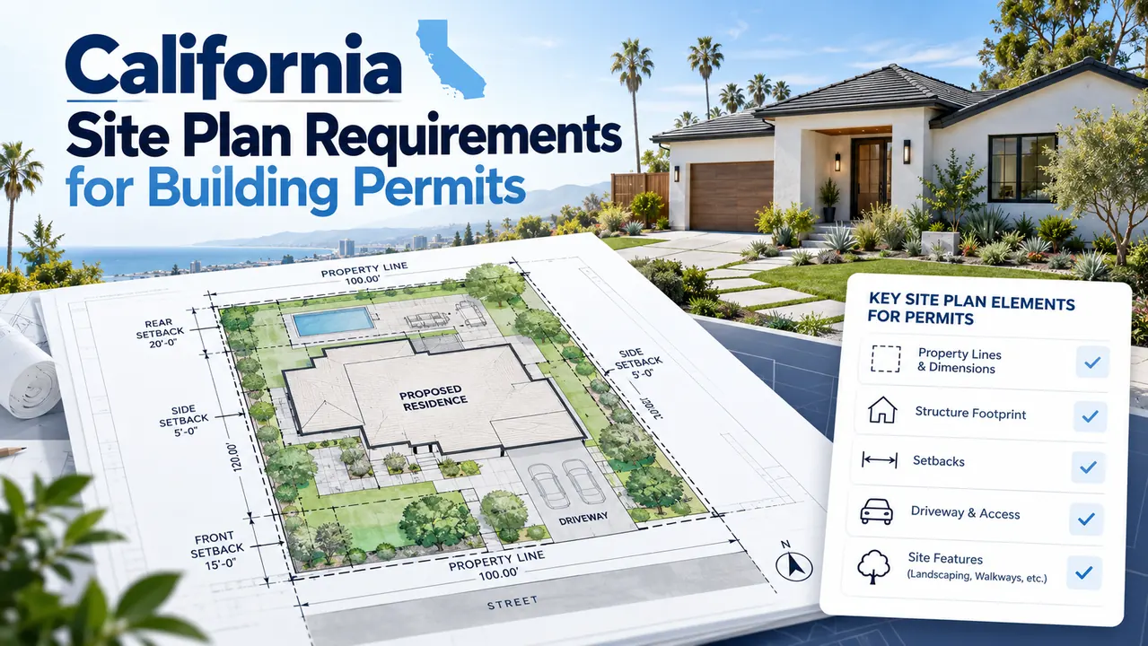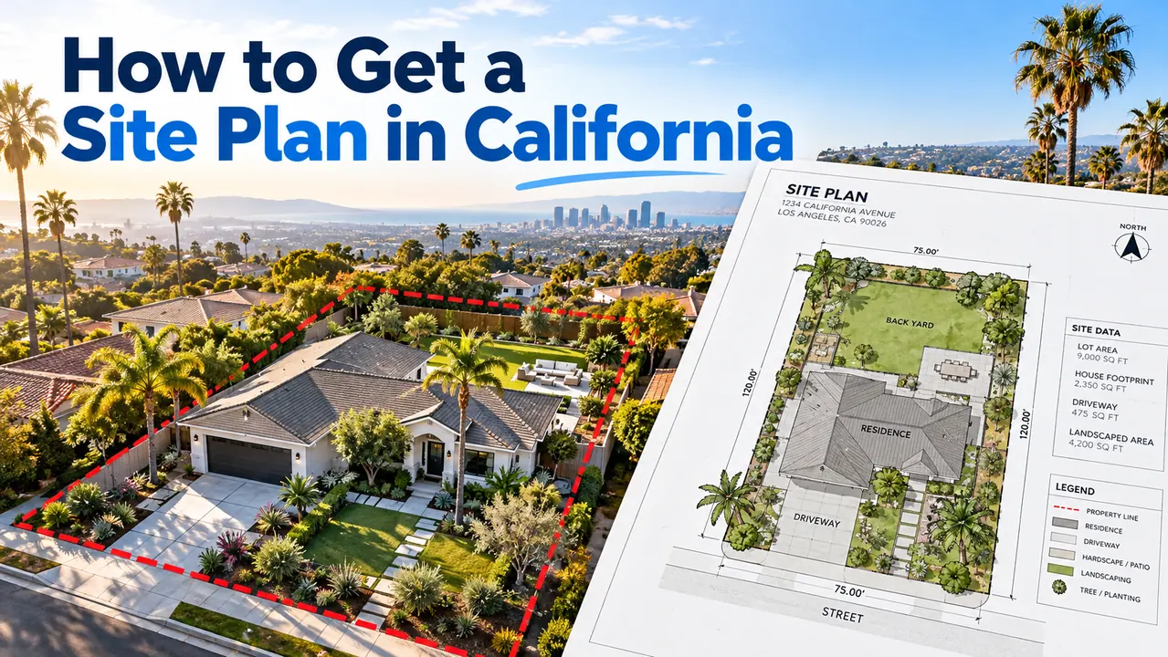
It is easy to say that a garage site plan needs property lines and setbacks. It is harder to sit down with a real property, decide which measurements belong on the sheet, and produce something a plan reviewer can read without guessing. This guide walks through a fictional California lot as though we were preparing the first draft of a detached garage permit drawing.
You will see the geometry, calculation method, layout alternatives, annotations, related drawings and common correction comments. The dimensions are teaching examples—not a survey, zoning determination or approved structural design. Use this as a checklist when discussing an actual garage with your jurisdiction or drafting team.
Quick answer: a credible detached garage site plan typically shows the parcel boundary and dimensions, street and access, existing improvements, proposed garage outline and size, dimensioned setbacks, easements, north arrow, scale, and any locally required area or drainage information. A site plan alone does not replace the floor, elevation, foundation, framing or other plans that the building department may request.
1. Our fictional property: the information we start with
Assume a rectangular parcel 60 feet wide and 110 feet deep. Its area is 6,600 square feet (60 × 110). The property fronts a public street along the 60-foot edge. An existing single-story house occupies a 32-by-45-foot footprint, and a 10-by-12-foot accessory shed sits near one side yard. The owner wants a detached garage behind the house.
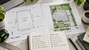
The first temptation is to draw a 22-by-22-foot garage where the lawn appears empty on satellite imagery. Instead, we begin with a more disciplined inventory. Which boundaries are documented? Is the lot truly a rectangle or does its recorded map show an irregular angle? Where does the existing house actually sit? Are there underground utility connections, drainage paths, trees to protect or access easements? Does the site have a rear alley?
We record the address, assessor’s parcel number, zoning designation and permit jurisdiction. An assessor map or GIS view helps locate records, but it should not be passed off as a completed legal boundary survey. If exact line locations are disputed or unclear, consult an appropriately licensed California land surveyor.
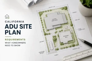
Only after reliable existing-condition measurements are assembled do we place proposed work. The garage is drawn as an outlined rectangle with a label such as PROPOSED DETACHED GARAGE — 22′-0″ × 22′-0″ = 484 SF. That label lets the reviewer identify what is new within seconds.
2. Make the proposed garage dimensions unmistakable
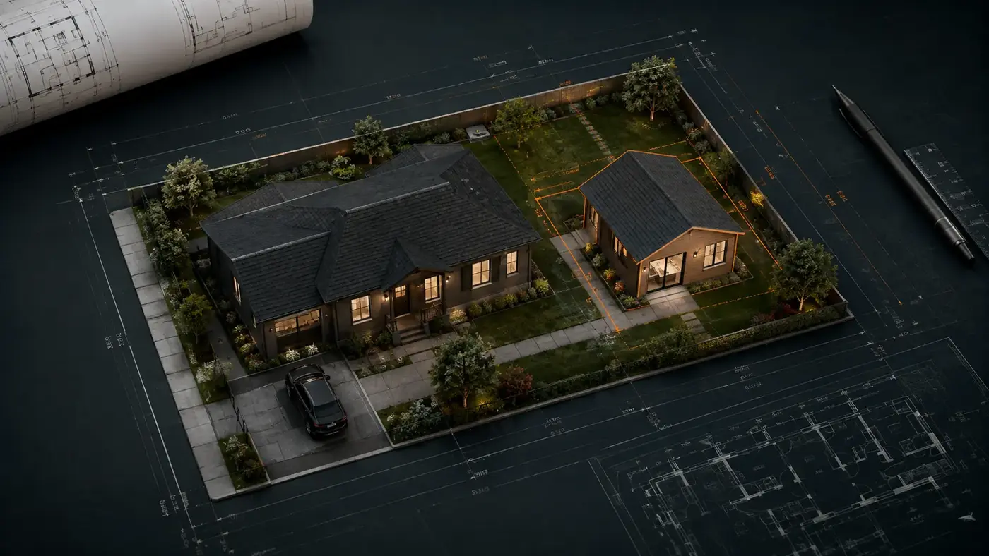
For this example, the new building is 22 feet wide and 22 feet deep. The 484-square-foot footprint is measured to the appropriate exterior faces; if the local definition uses different limits for site coverage, use those. Roof overhangs and covered projections should be shown if they affect setback or coverage review.
A four-sided dimension string is more useful than a lonely text label. Show width, depth and distances from the garage to the relevant property boundaries. Where the site is irregular, use perpendicular setback measurements and additional tie dimensions where necessary to locate the footprint unambiguously.
We also mark the overhead door side, pedestrian door where relevant and a plausible direction of vehicle approach. A garage turned the wrong way can be perfectly dimensioned yet functionally unusable. If the door faces an existing fence, the reviewer will want to know how the car enters.
Avoid letting CAD layers merge proposed and existing structures into an identical lineweight. A restrained graphic system works: solid gray or black for existing work, a heavier outline or subtle hatch for the proposed garage, dashed line types for easements, and clear legends for each. Color is helpful on-screen but the sheet should remain legible if printed in grayscale.
3. Demonstrating rear and side setbacks with sample numbers
For illustration only, suppose the local planning department confirmed a five-foot minimum side setback and a five-foot rear setback for this particular garage design. Those are hypothetical inputs, not statewide detached-garage requirements. California garage setbacks vary by jurisdiction and site conditions.
If the garage is placed five feet from the rear line and six feet from the right-side line, dimension 5′-0″ REAR (PROPOSED) and 6′-0″ SIDE (PROPOSED) directly on the plan. Do not rely on the reviewer to infer them from a scale bar. The projected roof eave may also need to be accounted for under the applicable measurement rules.
Next check the spacing between the garage and the existing house. A garage can satisfy property-line setbacks yet create an issue with building separation, fire-resistance-rated construction or access. Spacing between structures is not necessarily governed by the same zoning number as a side-yard setback.
The lesson is that a site’s empty space is not automatically its buildable space. Use the zoning standards, applicable building-code provisions and verified measurements together. If an easement overlaps the proposed building footprint, resolve it before spending money on a detailed structural design.
4. How to calculate lot coverage without guessing
An owner may ask whether the garage keeps the property within a 35% or 40% lot-coverage limit. The correct percentage must come from the jurisdiction, and the definition of countable building area must come from its zoning code. For this teaching example, we calculate a simple footprint ratio to demonstrate the arithmetic.
Existing house: 32 × 45 = 1,440 SF. Existing shed: 10 × 12 = 120 SF. Proposed garage: 22 × 22 = 484 SF. Preliminary combined building footprints: 2,044 SF. Site area: 60 × 110 = 6,600 SF. Preliminary ratio: 2,044 ÷ 6,600 × 100 = 30.97%.
That is not a claim that the local approved lot coverage is 30.97%. You must determine whether the shed counts, whether roof projections or covered porches are included, and how the locality defines floor area or lot coverage. Some jurisdictions distinguish building coverage from impervious surface coverage, which can include paved driveways and patios.
If the owner adds a 22-by-35-foot paved driveway, that pavement contributes 770 SF of newly paved area in this simple example. It does not automatically add 770 SF to building coverage, but it may affect impervious-area, runoff or drainage calculations. Do not combine unlike calculations under a single heading. Present a small table stating each definition and its source.
Our detailed lot coverage calculation article explains the distinction, with worked examples applicable to California zoning questions.
5. Access and driveway geometry are part of the picture
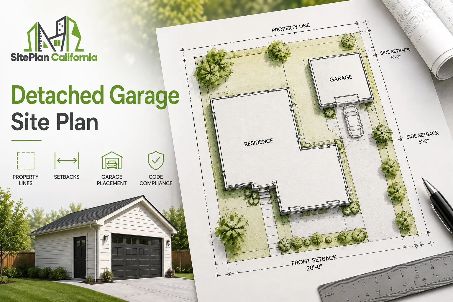
In a typical rear-yard garage proposal, access deserves as much attention as the garage box itself. Draw the street, existing curb cut, driveway edges and garage opening. Show the paved width and the connection to the building. If a shared drive or alley serves the parcel, label it accurately and show any recorded access rights.
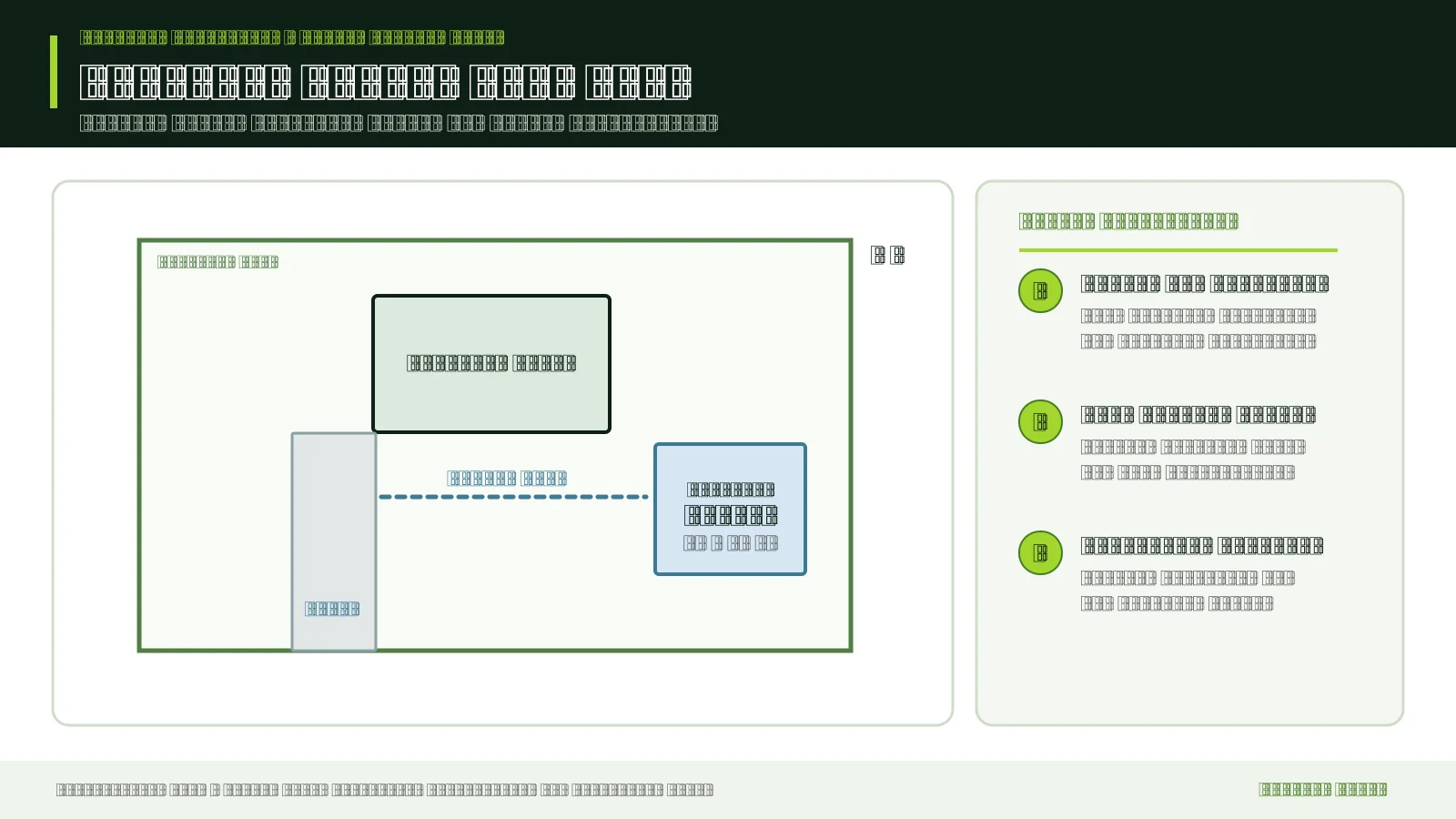
The designer should test whether a vehicle can physically enter, turn if needed and park without crossing an obstacle. A driveway that pinches beside the house might be insufficient under the local access standard even if the garage itself fits perfectly. The exact width, length, grade and turning requirements depend on the jurisdiction and use; do not invent a universal minimum.
Think about sightlines near the sidewalk, trees, utility poles and potential trenching. A new curb cut, work in public right-of-way or modification of drainage at the street may require separate transportation or encroachment review. Caltrans, for example, describes distinct encroachment permits for work affecting state highways; local streets are commonly administered by the city or county.
On the site plan, access is a spatial relationship. On a grading or driveway profile sheet, it becomes an elevation problem. A steep existing yard may call for spot grades or a driveway profile so the garage slab is accessible without creating water flow toward the house.
6. Decide whether a drainage note is enough—or a grading plan is needed
The proposed garage adds roofed area and may change surface grading. On a level urban lot, an approving agency might accept basic drainage arrows and a simple runoff narrative. On a sloping parcel, fill site or erosion-sensitive property, it may ask for an engineered grading and drainage plan with existing and proposed elevations.
Draw downspout destinations where required; note existing drains or swales that the garage footprint will interrupt. If fill or excavation is necessary, do not show a finished floor elevation with no supporting grade logic. Water should not be directed toward adjacent properties or trapped beside foundations simply because the driveway line looks convenient.
Where formal grading is needed, the plan may have to show contour intervals, cut/fill extents, retaining walls and erosion controls. El Dorado County’s official grading permit requirements illustrate the additional information some jurisdictions require. Do not copy that county’s specific sheet-size or contour rules into another jurisdiction without checking.
SitePlanCA treats ordinary site-layout drafting and engineering-grade civil design as distinct scopes because the latter depends on surveyed elevations, engineering calculations and sometimes professional licensing or geotechnical support.
7. Draw the sheet so a building official can review it quickly
A readable sheet includes project address, parcel identifier when requested, sheet title, revision/date, scale, north arrow, legend and concise existing/proposed notes. Put primary dimensions close to the elements they describe. Keep the title block separate from important site information, and avoid dimension text crossing property lines.
A useful orientation is to draw the street at the bottom if that makes the lot easiest to interpret, while retaining a correct north arrow. Keep the garage within a coherent plot scale—commonly one chosen in consultation with the plan reviewer based on site size and paper format. A scale such as 1″ = 20′ can work for many lots, but there is no one universal plotting scale.
Create an existing conditions layer with permanent improvements, an improvements proposed layer, and a separate layer for setbacks and easements. If a utility structure or drain is based only on owner information, label it as approximate and identify the need for field verification. Plans should not imply survey-level precision where it does not exist.
In the general notes, state the scope narrowly: “Construct new detached garage; existing dwelling to remain.” If the garage will receive a future ADU conversion, avoid casually labeling it “future living space” unless the jurisdiction has confirmed how that affects review.
8. The site plan is not the complete garage permit set
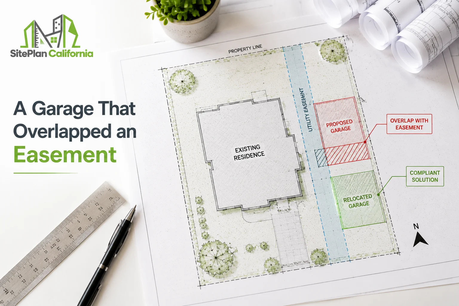
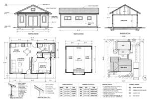
Suppose the site plan is approved by planning. The building division may still ask for a foundation plan, garage floor layout, roof framing, elevations, wall or bracing information and construction details. Wind and seismic design, lateral resistance, opening widths and local soil conditions may affect what is required.
A large vehicle door creates a significant opening in one wall. Foundation and lateral-load-path details need to account for it. The reviewer may need to see how the roof transfers loads through walls or frames to the foundation. Those are structural questions that cannot be answered by adding a generic note to a site plan.
For certain projects a California-licensed architect or engineer may be required to prepare, review, sign or seal documents. A drafting service should not guarantee a professional seal or permit approval when licensing, site verification and jurisdictional review have not occurred.
Make the distinction explicit when requesting a price: site plan only, architectural garage drawings, structural details/calculations, or full permit drawing package. The scope determines the documents, cost and turnaround.
9. Four realistic plan-check comments and how to resolve them
“Show distance to rear property line.” Add a dimension from the proposed garage exterior wall or specified zoning measuring point to the verified property line; do not use the fence as a surrogate unless it has been confirmed.
“Existing driveway is not shown.” Add the existing curb cut, paved access and route to the new garage. Include widths and any newly proposed paving required for review.
“Provide existing and proposed lot coverage.” Supply a calculation table with the local ordinance definition, include the existing footprint totals, add the proposed garage and note the resulting percentage. Resolve unclear accessory-structure treatment before resubmission.
“Clarify drainage at garage slab.” Show relevant finished-floor elevation, proposed adjacent grades, runoff arrows and downspout destination, or submit the separate civil grading/drainage documents the agency requests. Never invent elevation data from an aerial image.
A good correction response references the comment number, sheet number and revised detail. Submitting a clean revision cloud and a short response list typically makes review easier than sending an unlabeled drawing revision.
10. What the owner should send a site-plan drafter
The most useful handoff includes the street address and APN, survey or dimensioned existing site plan if available, assessor parcel map, proposed garage length and width, preferred placement marked on a current aerial, photos facing every direction and a description of how vehicles will access the building.
If you have a plot plan from a previous permit, send the original PDF or CAD file. Share planning notes about zoning setbacks and any utility easement. If the site slopes, include topographic information or request surveying guidance before assuming a simple layout drawing can provide final grading elevations.
Also disclose the intended garage use. A workshop with electrical service, a garage with a bathroom and a structure that might later become an ADU have different questions to resolve. The best site plan starts with a realistic project description rather than a vague rectangle marked “garage.”
Frequently asked questions
Can a detached garage site plan be drawn using Google Maps?
An aerial view is a convenient starting reference but does not independently establish legally accurate boundaries, measured setbacks or elevation data. Whether an owner-prepared plan is accepted depends on the local agency and the work involved.
What size drawing sheet should I use?
Use the jurisdiction’s electronic submittal instructions. Common permit sheets may be 11 × 17 or 24 × 36 inches, but don’t assume a single size is accepted across California.
Do I need to dimension the garage from all property lines?
Show enough dimensions to locate the structure unambiguously and demonstrate all relevant setbacks. Rear and side dimensions are particularly important for a backyard structure; front clearance and building separation may also matter.
Does a garage site plan need structural calculations?
The site plan itself generally communicates location, not structural capacity. A complete garage permit may require structural plans or calculations, depending on design complexity, adopted codes and the building official.
Can the garage become an ADU later?
Possibly, but conversion is a separate planning and building-code question. Do not assume a new garage designed only for vehicle storage will automatically meet future habitable-space, energy, utility or safety requirements.
Get a site plan that matches your actual garage project
If you are preparing a detached garage permit in California, SitePlanCA can develop a site/plot plan from available parcel information and verified measurements, and help define whether you also need architectural, structural or civil drawing services. Send the address, available survey, garage dimensions and preferred location; we can identify missing inputs before drafting.
Related: Detached garage requirements · Lot coverage calculations · Plan-check corrections.
Official references
- California Building Standards Commission — 2025 code collection
- City of Sacramento — Building plan review and acceptable preparers
- El Dorado County — Grading permit requirements
- Caltrans — Local development and encroachment review overview
All dimensions and compliance calculations in this worked example are hypothetical and must be replaced with parcel-specific verified information.