California Zoning & Setback Lookup
Resolve your property to the correct California jurisdiction, open the official zoning source, and turn zoning and setback information into project-specific guidance.
Get a more useful result
The tool identifies a research starting point and keeps setbacks you enter. It does not automatically certify your parcel's zoning, exact setbacks or property lines.
- Use a complete address to determine whether city or county rules apply.
- Enter the recorded zone or setbacks only if you have verified them.
- Compare the results with the zoning map, ordinances and property survey.
Example: Example: researching a five-foot side-yard requirement before a home addition.
Enter Your Project Information
Run the tool for an instant preview. Your complete analysis is prepared at the same time and emailed after the report form is submitted.
Building your project analysis…
Checking the inputs, project logic and available source context.
Your detailed report is prepared.
The complete report includes the full checklist, source links, unresolved items, calculations or rule findings, and recommended next actions.
Your complete analysis
A copy has also been sent to your email.
Useful Answers Without Pretending Every Property Is the Same
Tell us about the property
Your address and project details establish the context.
Run the tool logic
Project-specific rules and calculations evaluate the inputs.
Check local context
Official building and planning sources appear when available.
Receive the full report
Preview the result instantly, then email the full analysis to yourself.
Why Zoning Comes Before Design
Zoning controls allowed uses and commonly affects building placement, height, lot coverage, density, parking and other development standards. A useful result explains which standards are likely relevant to the user's project.
Use Official GIS as the Source of Truth
California cities and counties use different zoning and GIS platforms. The tool resolves the likely city and county, then surfaces official local planning links from SitePlan California's location data when available.
Setbacks Need Context
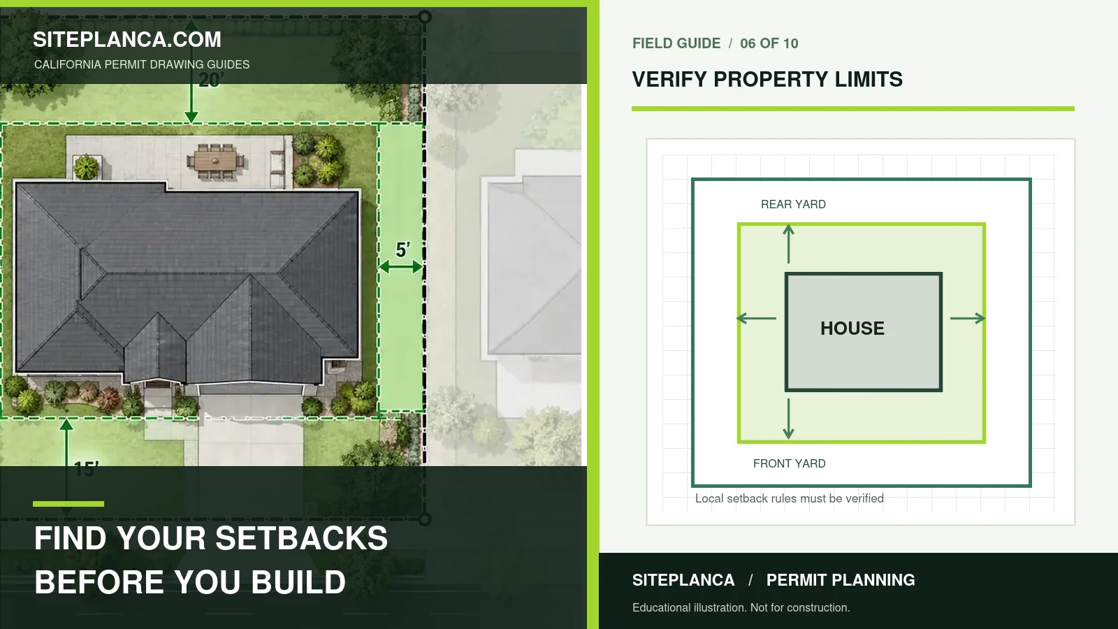
Front, side, street-side and rear setbacks can vary by zone, lot type and special rule. Corner lots, alleys, overlays and prevailing-setback rules can change a simple base-zone value.
Strong Tools Explain What Is Known, What Is Estimated, and What Still Needs Verification.
Use the Result Correctly Before You Commit Time or Money
Connect Zoning to the User's Project
An ADU, pool, deck, garage or addition can be affected by different standards. The tool asks what the user plans to build and explains the zoning factors most likely to matter.
GIS Boundaries Are Not a Survey
Planning and parcel maps are research tools, not automatically legal boundary surveys. Exact boundary, easement or field-condition work may require a licensed surveyor.
Why Base Zoning Is Only the First Layer
A base zoning designation is useful, but it may not capture overlays, specific plans, historic controls, hillside rules, coastal review, fire constraints or other property-specific standards. The tool treats the zoning code as the beginning of interpretation and keeps local-source verification visible so users do not mistake a single code label for a complete development answer.
How to Record Setbacks Correctly
When you find setback values in an official zoning table or property-specific source, record whether they apply to the front, interior side, street side or rear yard and note any special lot condition. A value copied without its context can be misleading. The tool therefore keeps the entered setback and the jurisdiction source separate from any assumption about exact boundary location.
When a Survey May Still Be Needed
If the proposed improvement depends on a tight property-line relationship, easement, encroachment, legal boundary or other field condition, online parcel data may not be enough. A licensed surveyor may be needed to establish exact boundary information. The zoning tool helps with planning context but does not replace professional boundary work.
California Zoning & Setback Lookup FAQs
These answers explain how to interpret the tool and when local or professional verification still matters.
Can I look up zoning by address?
The tool resolves the address to the likely jurisdiction and official planning source. Exact parcel zoning is returned automatically only when a connected property-data provider supplies it.
Are the setbacks shown legally binding?
No. They are preliminary or user-supplied unless the result explicitly identifies a verified local source.
What is an APN?
An Assessor's Parcel Number is a county parcel identifier commonly used in assessor and GIS systems.
Why does my zoning code not tell me everything I can build?
Overlays, specific plans, lot conditions, use rules and project type can add requirements beyond the base zone.
Can zoning data be used to prepare a site plan?
Yes, as planning context. Exact property boundaries or field conditions may still require survey or other verified information.
Can the tool show overlays and special plans automatically?
Only when a connected property-data source provides them. Otherwise the result directs the user to the official local planning system.
Do setback values use the GIS parcel line?
They should not be treated as exact field setbacks unless the controlling property boundary has been properly verified.
Need a plan for your property?
This tool is a starting point. Send the property address, proposed work, and any city comments so we can confirm the drawing scope.
Request a project review for your zoning or setback question