California Parcel Map & APN Lookup
Start with a California address to identify the county, map the property location, open official parcel resources, and organize APN information for site-plan research.
Get a more useful result
Organize the county assessor/parcel lookup and any APN already known. County GIS geometry can be approximate and may differ from surveyed boundaries.
- Enter the property address, and the assessor parcel number if known.
- Open the official county parcel and assessor resources in the report.
- Use a licensed survey when boundary accuracy is essential.
Example: Example: identify APN and lot records before placing a backyard shed.
Enter Your Project Information
Run the tool for an instant preview. Your complete analysis is prepared at the same time and emailed after the report form is submitted.
Building your project analysis…
Checking the inputs, project logic and available source context.
Your detailed report is prepared.
The complete report includes the full checklist, source links, unresolved items, calculations or rule findings, and recommended next actions.
Your complete analysis
A copy has also been sent to your email.
Useful Answers Without Pretending Every Property Is the Same
Tell us about the property
Your address and project details establish the context.
Run the tool logic
Project-specific rules and calculations evaluate the inputs.
Check local context
Official building and planning sources appear when available.
Receive the full report
Preview the result instantly, then email the full analysis to yourself.
What a Parcel Map Can Tell You
Parcel maps and assessor records can help identify a parcel number, approximate lot shape, parcel references, lot area and related public property information. They are common research sources when organizing a preliminary property base.
Why APN Search Matters
Some county systems do not reliably search vacant land or unusual addresses but do accept an APN. The APN can be saved into the SitePlan California project record and reused across the other tools.
Official County Maps Should Be One Click Away
The tool shows the county and the strongest official local resource available instead of hiding the source behind a generic result.
Strong Tools Explain What Is Known, What Is Estimated, and What Still Needs Verification.
Use the Result Correctly Before You Commit Time or Money
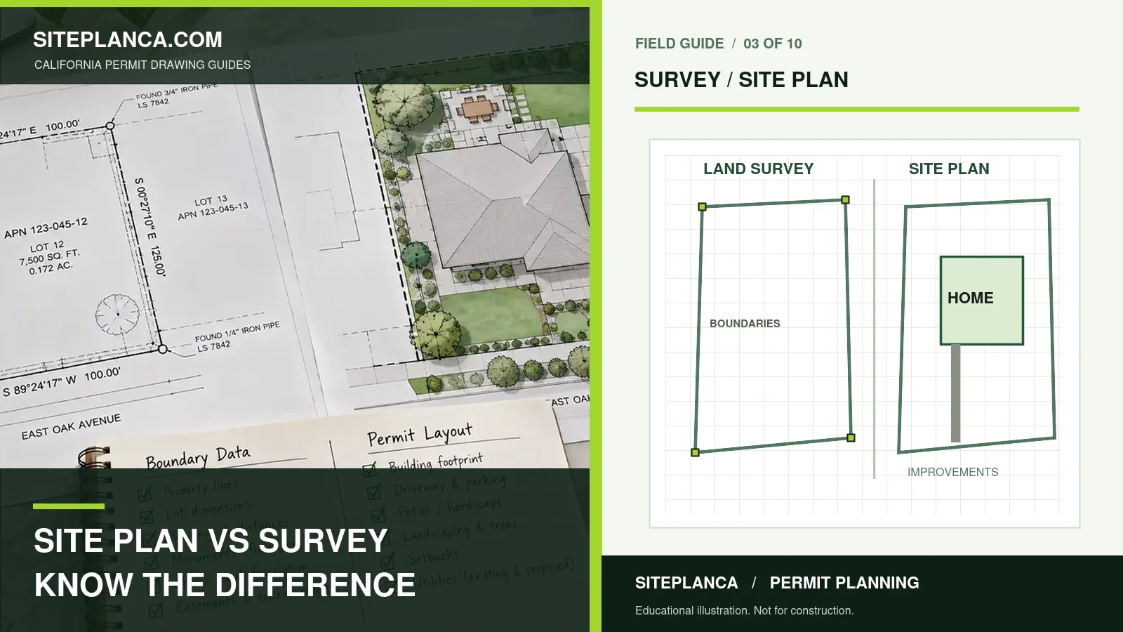
Parcel Map vs Property Survey
An assessor parcel map or GIS boundary is not automatically a legal boundary survey. Public parcel data can support preliminary planning but should not be represented as field-verified survey information.
How Parcel Data Supports a Permit Site Plan
Parcel data can help establish orientation, lot shape and a preliminary property framework. It becomes more useful when combined with a prior survey, existing plans, property photos and project measurements.
Why County Parcel Sources Matter
California parcel identifiers and assessor maps are administered locally, so the most dependable public record is usually the county assessor or county GIS system. The tool is designed to identify the county first, preserve the APN when known, and route users toward the official source instead of inventing a statewide parcel record.
What Public Parcel Data Is Good For
Public parcel data is useful for orientation, preliminary lot shape, assessor references, parcel identification and early property research. It can support the creation of a preliminary drafting base when combined with other records. Its value is highest when the source and limitations remain visible throughout the project workflow.
What Public Parcel Data Is Not Good For
A GIS line on a web map should not be treated as a surveyed property boundary, a verified easement location or a guarantee of buildable area. If the permit or project depends on exact legal dimensions, field monuments, topography or easements, the appropriate licensed professional should verify those conditions.
California Parcel Map & APN Lookup FAQs
These answers explain how to interpret the tool and when local or professional verification still matters.
Can I find an APN from a street address?
The tool resolves the address and county, then routes to configured official parcel resources. Automatic APN return depends on a connected parcel-data provider.
Are property lines on online maps exact?
No. Public GIS and assessor lines can be approximate and should not be represented as a licensed field survey.
Can I use an APN instead of an address?
Yes. The tool accepts an APN so it can be saved into the project record.
What if the property has no street address?
Use the APN and county parcel search. Vacant parcels are commonly easier to locate by parcel number.
Can this data be used for my permit site plan?
It can support preliminary drafting, but final source requirements depend on the project and reviewing agency.
Why is my APN not returned automatically?
California parcel data is fragmented by county. Automatic APN retrieval requires a connected parcel-data provider or county-specific integration.
Can I save the APN for other tools?
Yes. The project record can carry the APN and address into later zoning and permit workflows.
Need a plan for your property?
This tool is a starting point. Send the property address, proposed work, and any city comments so we can confirm the drawing scope.