Tell us about the property
Your address and project details establish the context.

Calculate a site grade's rise, fall, percent slope, angle and horizontal-to-vertical ratio from surveyed or measured elevations.
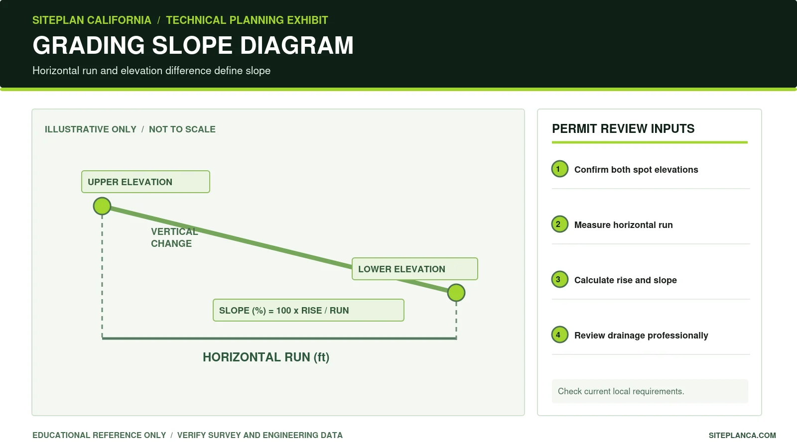
Enter two elevations from the same vertical datum and a horizontal plan distance. Results describe one line segment, not a finished drainage design.
Example: From elevation 105.50 to 103.50 over 50 horizontal feet is a 4% fall toward the end point.
Run the tool for an instant preview. Your complete analysis is prepared at the same time and emailed after the report form is submitted.
Checking the inputs, project logic and available source context.
The complete report includes the full checklist, source links, unresolved items, calculations or rule findings, and recommended next actions.
A copy has also been sent to your email.
Your address and project details establish the context.
Project-specific rules and calculations evaluate the inputs.
Official building and planning sources appear when available.
Preview the result instantly, then email the full analysis to yourself.
Slope is the difference in vertical elevation divided by the horizontal distance between the measured points. A reliable calculation starts with an upper and lower spot elevation, or two numbered grades, tied to the same vertical datum. The horizontal distance should be measured in plan, not along the inclined ground surface. This tool uses feet for elevation and feet for run.
Signed slope percent equals (end elevation minus start elevation) divided by horizontal run, multiplied by 100. If the start is at 105.50 feet, the end is at 103.50 feet and horizontal run is 50 feet, the signed slope is minus four percent, meaning a four-percent fall in the direction from start to end. The absolute slope magnitude is four percent.
The tool shows both signed elevation change and the absolute rise or fall. A negative change means that the end point is lower than the start; a positive change means it is higher. Water does not necessarily follow a single two-point section when the surrounding site has multiple grades, obstacles or surface depressions. The result should not be taken as a full drainage-flow analysis.
Civil drawings sometimes express slope as H:V, or units of horizontal run to one unit of vertical change. A two-foot fall over fifty horizontal feet is 25:1 H:V, equivalent to four percent grade. For a level section, a finite H:V ratio cannot be stated meaningfully, so the tool labels it as level. A 1:1 grade corresponds to a 100 percent slope, not a one-percent slope.
The slope angle is the arctangent of rise divided by horizontal run, converted from radians to degrees. It may be more convenient for comparing steepness, while grading plans and stormwater reviewers commonly use percentage or profile elevations. This calculator displays the absolute angle as a numerical cross-check.
For planning you can optionally enter a maximum slope percentage supplied by the applicable project criteria. The tool compares the magnitude of the calculated slope with that entered threshold. This is not a code lookup and the entered number is not independently verified. A calculated value below the threshold still does not prove that the surface is accessible, drainable, constructible or safe.
A permit grading plan can require existing and proposed spot elevations, contours, drainage arrows, swale and inlet details, cut-and-fill information, erosion control and runoff calculations. Design and requirements vary with lot slope, paving, building changes, stormwater rules and local jurisdiction. A two-point slope calculation cannot replace an engineered grading or drainage plan.
Both elevations should refer to the same benchmark or vertical datum. Do not mix assumed slab height with surveyed NAVD88 or another reference without proper conversion. If the horizontal run is inferred from a resized drawing, first verify the drawing scale. Very small runs can produce misleadingly high slopes, so use actual reliable measurements.
A slope calculation may be included in an engineering profile, driveway section, walkway review or site drainage analysis when it is based on defensible measurements. Check grade direction, transition elevations and adjacent points; coordinate professional review for code-sensitive access, foundations and drainage.
These answers explain how to interpret the tool and when local or professional verification still matters.
Subtract starting elevation from ending elevation, divide by horizontal run, and multiply by 100. Negative means falling toward the end point.
The magnitude is 4 percent, a 25:1 horizontal-to-vertical slope. Signed slope is minus 4 percent from the higher start to the lower end.
No. Four percent slope corresponds to approximately 2.29 degrees. Percent slope and angle are different measures.
No. Applicable slope limits, cross slopes, landings, transitions and surface requirements must be verified for the relevant route and code.
The result is a level zero-percent grade with no finite H:V ratio.
Convert it from measured geometry first. The slope percentage formula needs horizontal distance, not length measured along the incline.
No. Local runoff, boundary conditions, soil, stormwater conveyance and proposed finished grading require site-specific civil analysis.