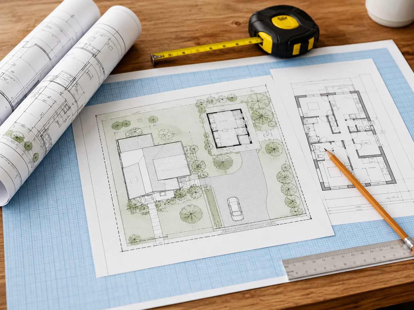
Permit Site Plans in California for Residential and Commercial Projects
A permit site plan should do more than place a few boxes on a parcel. It should clearly communicate the existing property, the proposed work, critical dimensions, access, setbacks, and other site information that helps a reviewer understand how the project fits on the lot. SitePlan California prepares professional permit site plan drawings for homeowners, contractors, builders, developers, architects, permit expediters, real-estate professionals, and property managers throughout California.
Whether you are planning an ADU, home addition, garage, pool, deck, accessory structure, commercial improvement, demolition project, or another property change, we can review the available information and prepare a project-specific site plan rather than forcing every job into the same generic template.
Clear, readable permit-focused CAD documentation
A Scaled Property Drawing That Explains the Site Clearly
A permit site plan is a plan-view drawing of the property that shows how buildings, structures, improvements, access areas, and relevant site features relate to the lot. The exact information requested depends on the local jurisdiction and the type of permit. In California, there is no single universal checklist that every city and county uses for every project. A small patio cover may require a different level of detail than a new detached ADU, a commercial addition, or grading work on a sloped property.
What remains consistent is the need for clarity. A reviewer should be able to identify the property, understand what exists today, see what is proposed, and locate the work in relation to property lines and other important site conditions. That is why a good site plan is more than an aerial image or rough sketch. It is an organized drawing that brings together the available property records, survey information when available, client measurements, existing drawings, photographs, project dimensions, and known permit requirements.
Official guidance illustrates the level of information jurisdictions can expect. Los Angeles City Planning publishes plot-plan instructions and states that additional information may be required depending on the case. The City of San Diego explains that construction-permit site plans may need to show property lines, lot lines, easements, rights-of-way, buildings, and structures on the parcel. The practical lesson is simple: the drawing should be tailored to the property and the reviewing department, not copied from an unrelated project.
The Details Reviewers and Project Teams Need to Understand the Property
The elements below are commonly shown on permit site plans, but they are not automatically required on every project. We select and organize the information according to the project scope, available documentation, and known jurisdiction requirements.
Property Boundaries
Lot lines and parcel dimensions can be shown from appropriate source information. Where verified boundary location is critical, a licensed survey may be required rather than relying on drafting assumptions.
Existing Structures
The house, garage, accessory buildings, commercial structures, sheds, and other relevant improvements can be identified so the reviewer understands the current property layout.
Proposed Work
New additions, ADUs, pools, decks, garages, patios, demolition areas, or other improvements are clearly distinguished from the existing condition.
Setbacks & Dimensions
Relevant distances between proposed work, existing structures, and property lines can be shown where the necessary project and property information is available.
Access & Circulation
Driveways, walkways, gates, parking areas, loading areas, or other circulation features may be shown when they affect the project or are requested for review.
Easements & Utilities
Known easements, utility locations, or related site constraints can be documented when reliable information is supplied or available from project records.
Lot Coverage
Existing and proposed coverage information may be included when it is part of the permit scope and sufficient dimensions are available for the calculation.
North Arrow & Scale
Plans are organized so orientation, scale, key dimensions, labels, and drawing notes are easy to read and useful to the broader permit package.
Project Notes
Site-specific notes can help explain the proposed work, clarify what remains unchanged, and coordinate the site plan with other drawings in the project set.
Most Problems Begin With Missing, Unclear, or Unsupported Site Information
A site plan can look visually polished and still create problems during review if the drawing does not answer the reviewer’s basic questions. Common issues include missing dimensions, inconsistent property information, unlabeled existing versus proposed work, incomplete setback information, unclear access, or a drawing that was copied from a standard template without being adapted to the actual parcel.
Another frequent problem is treating approximate information as verified. Online parcel maps, aerial imagery, assessor data, and client measurements can be useful drafting references, but they are not automatically interchangeable with a boundary survey. When a project depends on the exact location of a property line, easement, slope, or elevation, the correct professional source may be required. Good drafting should make the information more understandable without overstating the certainty of the source data.
Permit departments may also request information that was not obvious at the beginning of the project. Local zoning, fire access, grading, drainage, public-right-of-way conditions, overlays, coastal requirements, hillside rules, or other project-specific regulations can affect the plan set. That is why we approach correction comments as project information rather than treating them as a failure. When the requested change is within the drafting scope, the plan can be updated to respond more clearly.
What Helps Prevent Unnecessary Corrections
- Use the best available property information before drafting begins.
- Clearly separate existing conditions from proposed improvements.
- Show the dimensions that actually explain the proposed work.
- Match labels and dimensions across the site plan and related drawings.
- Review written permit comments carefully before making revisions.
- Do not represent unverified boundaries or elevations as professionally surveyed information.
Important Scope Boundary
SitePlan California provides site-plan and drafting services. Some projects require a licensed architect, professional engineer, civil engineer, land surveyor, geotechnical consultant, energy consultant, or other licensed professional. A drafting service does not replace those professional requirements when a jurisdiction or project scope requires them.
From Property Information to a Permit-Ready Drafting Package
Provide the property address, proposed work, and any survey, existing plans, measurements, photographs, sketches, or permit comments you already have.
We review the available source information and identify what can reasonably be drafted, what details are missing, and whether separate professional information may be needed.
The existing property and proposed work are organized into a clear plan with the applicable dimensions, labels, notes, and project-specific site information.

You review the draft for project accuracy. Applicable drafting changes are incorporated within scope before the final PDF and other agreed files are delivered.
Why Local Jurisdiction Requirements Matter
California projects are reviewed by different cities, counties, and special agencies, so the required drawing set can vary significantly. A site plan prepared for a project in the City of Los Angeles may be reviewed differently from a project in unincorporated Los Angeles County, San Diego, Sacramento, Riverside, Orange County, or a smaller city. Even within the same jurisdiction, the scope of work can change what information is expected.
For example, Los Angeles City Planning publishes specific plot-plan instructions and notes that additional materials may be requested. San Diego’s Development Services guidance describes site plans as drawings that can include property lines, easements, rights-of-way, buildings, and structures, while the County of San Diego publishes minimum plot-plan information for building projects. These are useful examples of a broader rule: the local reviewing authority controls the actual submittal requirements for your permit.
Our role is to make the drafting side easier to coordinate. We prepare the plan around the project information available, organize the drawing clearly, and incorporate jurisdiction-specific information when it is known and within scope. We do not promise that one standard drawing will satisfy every department in California, because that would not be a responsible representation of how permitting works.
Permit Site Plans for More Than One Type of Property Improvement
Permit site plans are used across a wide range of residential and commercial projects. The drawing requirements change, but the core objective remains the same: explain the property and show how the proposed work fits within it. We support common homeowner projects as well as drafting coordination for contractors, architects, builders, developers, permit expediters, and property managers.
ADUs & JADUs
Existing and proposed property layouts for detached ADUs, attached units, garage conversions, and Junior ADU projects.
Home Additions
Site plans showing the existing residence, proposed expansion, relevant setbacks, dimensions, and property relationships.
Garages & Accessory Structures
Plans for detached garages, carports, workshops, sheds, and other accessory structures that affect the property layout.
Pools, Decks & Patios
Property layouts for pools, spas, decks, patios, pergolas, patio covers, fences, and related outdoor improvements.
Commercial Improvements
Site documentation for commercial additions, parking changes, circulation, tenant improvements, and multi-building properties.
Demolition & Rebuild
Existing and demolition layouts showing what is proposed for removal, what remains, and how future work relates to the site.
Drafting Support for Homeowners and Professional Project Teams
Homeowners often come to us because they need a clear site plan but do not work with permit drawings every day. Contractors and builders may already understand the construction scope but need clean documentation for a permit package. Architects and designers may need a site-plan base that coordinates with the rest of the drawing set. Permit expediters may need revisions organized quickly after plan-check comments.
We adapt the communication and drafting workflow to the client. A homeowner should not need to become a CAD expert to explain a backyard project, while a professional team should be able to send dimensions, markups, or reference drawings and receive organized drafting that fits into the larger workflow. That flexibility is one of the main benefits of a specialized site-plan service.
SitePlan California operates under Avenzo Digital LLC and supports projects throughout California. Our focus is site-plan drafting and property documentation, with clear scope boundaries when a project needs licensed engineering, surveying, architecture, or another professional discipline.
Tell Us About Your Permit Site Plan Project
Start with the property address and a short description of the proposed work. If you already have a survey, existing drawings, photos, dimensions, sketches, or permit correction comments, mention them in the project details. We will review the request and follow up with the next information needed for the drafting scope.
Request Your Free Quote
What You Can Expect From the Drafting Scope
Deliverables depend on the project, but a typical permit site plan engagement may include a PDF site plan showing existing and proposed conditions, relevant dimensions, setbacks, structures, access areas, notes, and other site information included in the agreed scope. CAD or DWG source files can also be provided when they are part of the project agreement.
We encourage clients to review the first draft carefully. The client is often the best source for confirming practical project details such as the location of a proposed fence, the dimensions of a new patio, or whether an existing shed is staying or being removed. That review helps reduce avoidable inconsistencies before the drawing is incorporated into the broader permit package.
If a city or county issues written correction comments, send them to us rather than paraphrasing them from memory. The exact language can matter. We can review drafting-related comments and update the plan when the requested revision is within scope. If the reviewer is requesting engineering calculations, a survey, geotechnical work, energy documentation, stamped professional plans, or another service outside general drafting, we will keep that requirement separate rather than representing it as something a site-plan drawing alone can solve.
Common Questions About California Permit Site Plans
What information do you need to start a permit site plan?
Do I need a land survey for my permit site plan?
Can you prepare a permit site plan anywhere in California?
Can you prepare site plans for ADUs, additions, pools, and garages?
Can you revise the site plan after permit comments?
What file formats can you provide?
How accurate is a site plan created from online property information?
Do you guarantee permit approval?
Send the Property Address and Tell Us What You’re Planning
We will review the project information, identify the drafting scope, and help you move toward a clearer permit submission.